SITES STATION
Skogaryd
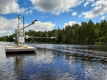
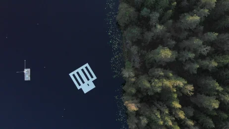
The Skogaryd Research Catchment offers studies on a variety of ecosystems, i.e. mires, mature and young forests, lakes and streams. Research focuses on the quantification of greenhouse gas balances on a landscape scale, including land-atmosphere, land-water, and water-atmosphere exchange, promoting cross-habitat-boundary research.
Sweden
79 m
Altitude
6.2 °C
Mean annual temperature
837.0 mm
Mean annual precipitation
Detailed information
SRC
SE
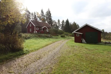
Skogaryd Research Catchment is located 100 km north of Gothenburg in Sweden. The base measurement program at Skogaryd includes greenhouse gas (GHG) flux measurements from terrestrial and limnic ecosystem, using a range of different methods, as well as stream flow and chemical analyses. The Skogaryd Research Catchment promotes biogeochemical, ecological, eco-physiological and within-canopy chemical research. Researchers are provided with a high-tech infrastructure in the field. Advanced instruments are used for flux measurements of abiotic and biotic parameters. Cabins in Skogaryd are used for lodging, office, education, and storage. A field crew with local knowledge and expertise on monitoring instrumentation can assist during fieldwork. A workshop for wood and plastics hand craft as well as work related to electronic repairs and development are provided. A nearby farm provides an advance workshop for repair of field equipment.
6.2 °C
58.3738, 12.1648
79 m
Year-round